Every day, thousands of vehicles travel across bridges that connect cities, communities, and trade routes. These structures carry not only cars and trucks but also the weight of safety and trust. Ensuring that every bridge remains strong and stable is a responsibility that cannot be taken lightly.
Traditional inspections require workers to climb high structures, use scaffolding, or operate from boats below. It is a time consuming process that also exposes people to risk.
Today, technology offers a better way. The DJI Mavic 3 Enterprise (M3E) makes bridge inspections faster, safer, and more precise by capturing detailed data from the air.
Why Bridge Inspections Are Challenging?
Bridges face constant stress from weather, water, and daily traffic. Over time, small cracks or corrosion can lead to bigger problems. Inspecting every section by hand is not only slow but also dangerous.
These challenges make it clear why the industry needs smarter solutions for accurate, efficient monitoring.
How DJI Mavic 3E Makes Inspections Smarter?
The DJI Mavic 3 Enterprise is designed for professional surveying and geospatial data collection. It captures high quality aerial imagery that helps engineers monitor bridge structures in detail without putting anyone at risk.
Equipped with a 20 megapixel camera and large CMOS sensor, the M3E captures clear, high resolution images.
Its RTK precision system ensures centimeter level accuracy, allowing engineers to detect even minor changes in structure.
Integrated with DJI FlightHub 2, teams can plan missions, track progress, and monitor live footage remotely.
Using DJI Terra, the collected data is transformed into 2D maps, 3D models, and point clouds for analysis and reporting.
The result is a complete digital view of the bridge from every angle.
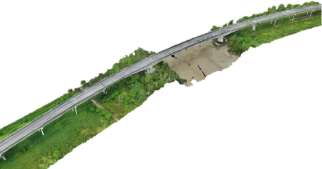
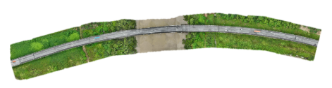
2D Map Model of Bridge 3D Map Model of Bridge
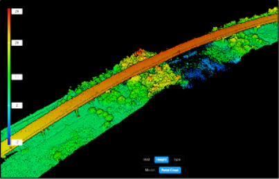
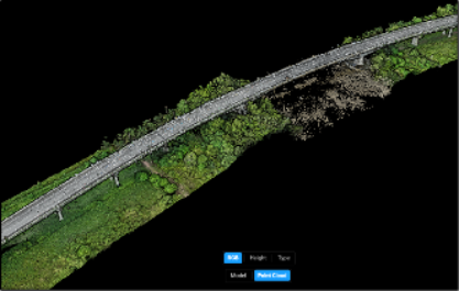
RGB Point Cloud Model of Bridge Height Point Cloud Model of Bridge
From Data to Insight
With the DJI Mavic 3E and DJI Terra working together, engineers can:
By turning imagery into actionable data, engineers can detect potential risks early and plan maintenance efficiently.
Real Result in the Field
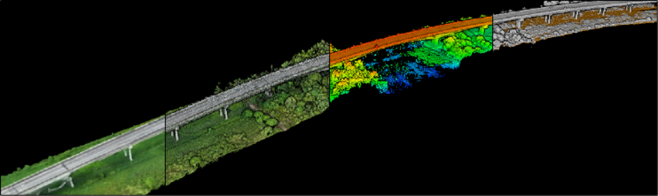
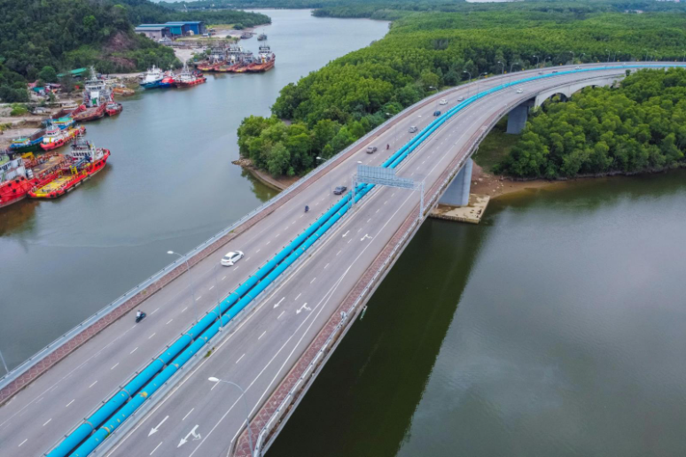
During one project, the Mavic 3E was deployed to inspect a bridge that spanned a river in a difficult to access area. Within minutes, the drone completed a full survey flight, collecting hundreds of high resolution images.
Using DJI Terra, the team generated a 3D model that revealed structural details which were previously impossible to observe safely. The process took less than half the time of traditional methods and required only one operator instead of an entire team.
Benefits of Adopting Drone Based Inspections
By integrating drones into inspection routines, engineers can focus on analysis and maintenance instead of manual documentation.
Conclusion
The DJI Mavic 3 Enterprise is redefining how bridge inspections are performed. By combining precision mapping, real time collaboration, and advanced data visualization, it allows engineers to manage infrastructure with greater confidence and care.
This shift from manual work to smart technology is not just about speed. It is about safety, sustainability, and building a future where infrastructure management is powered by accurate data and intelligent tools.