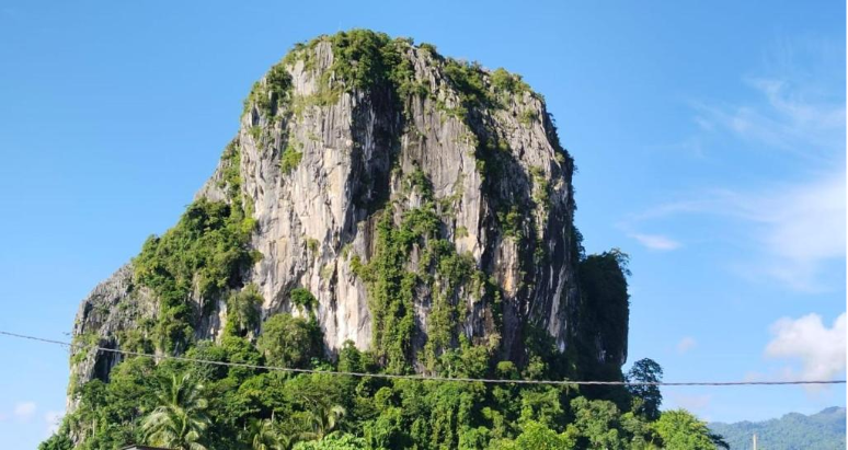
There is something timeless about Gunung Reng. The limestone hill stands quietly in Jeli, Kelantan, surrounded by forests and stories that locals still tell today. Some believe it was once a village swallowed by a great flood. Whether myth or memory, the place carries a calm that draws people in. Families stop here for picnics, hikers explore the caves, and travellers pause just to take in the view.
We have always admired how beautiful it is, but we also know how fragile places like this can be. The cliffs are steep, the paths uneven, and the weather is unpredictable. Keeping it safe for visitors while preserving its natural state is not an easy task.
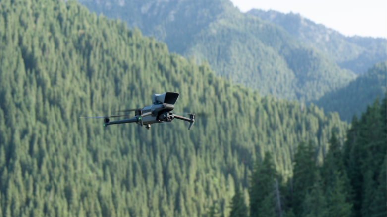
That is why decided to see Gunung Reng from a new perspective. Using a DJI Mavic 3E, we carried out a complete 3D mapping mission of the area. Instead of walking along the long trails or climbing rocks, the drone flew over the hill and its forest, capturing thousands of sharp images from different angles.
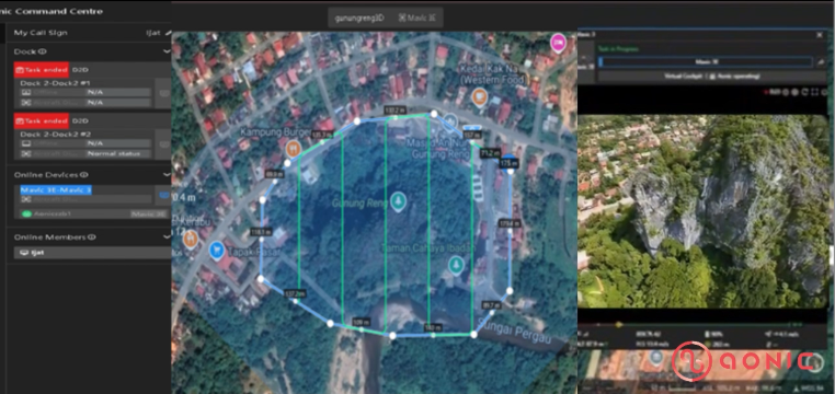
Each flight was carefully planned in DJI FlightHub 2, and we could watch everything live from the ground. It felt almost like exploring the place again, but this time through a bird’s eye view. When the flights were done, we processed all the images in DJI Terra to build a digital version of Gunung Reng.
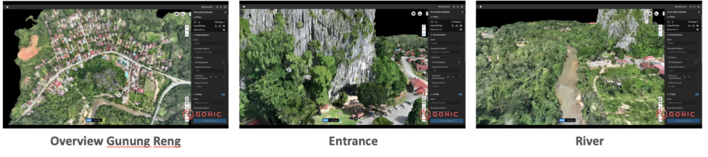
Seeing it appear on screen was surreal. Every slope, every curve of limestone, even the shadows where the forest meets the rock, everything was there. The 3D model looked so real that it felt like standing on the hill itself.
This digital map has since become more than just a visual. It helps those who look after the site monitor cracks and shifts in the limestone, understand how rainwater moves around the hill, and the spot areas that may need maintenance. What once required days of inspection now takes only a few hours.
Working from the air also means less risk. No one needs to climb uneven terrain or walk close to steep cliffs. The data we gather from above is detailed, accurate, and easy to share. Every mission gives us clearer insight into how the landscape changes with time.
Beyond the technical side, this project means something personal to us. Gunung Reng is a part of our heritage. It is a piece of Kelantan’s story, a place that deserves to be seen, understood, and protected. By mapping it in three dimensions, we are helping ensure that its beauty lasts for generations to come.
Conclusion
The DJI Mavic 3E, paired with DJI Terra and FlightHub2, helped us rediscover this place in a way we never could before. Through the lens of technology, we found a new way to connect with nature, not to control it but to understand it better.
What started as a mapping mission turned into a reminder of why we do what we do. It is about protecting what matters, learning from the land, and appreciating the quiet stories that live within it.