
The minerals industry plays a vital role in the global economy. From construction to manufacturing, technology, and energy production, minerals provide the raw materials that keep the world moving. But managing these resources is not easy.
Surveying stockpiles and structures is a critical part of the job, yet traditional methods are often slow, risky, and expensive. Workers spend long hours in dangerous conditions, and even then, results can be inconsistent.
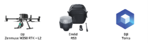
Today, a new solution is changing the way surveys are done. With the DJI Zenmuse L2 LiDAR sensor, mounted on the DJI Matrice 350 RTK drone, and supported by the Emild RS3 GNSS receiver and DJI Terra processing software, mineral exploration has become faster, safer and far more accurate.
Challenges in Mineral Exploration
Surveying stockpiles and structures in mines is not easy. Common problems include:
To overcome these issues, the industry needs a solution that is fast, consistent, and data driven.
Equipment and Uses
DJI’s ecosystem offers a complete solution designed to address these issues:
With these tools, inspection teams can collect millions of data points in minutes, delivering accurate and repeatable results that manual surveys cannot match.
Mission Execution
A structured workflow ensures the best results. The case study followed three main stages:
Using DJI Pilot 2, the team designed flight routes over the survey area. Parameters like altitude, scanning mode, and overlap were set to ensure complete coverage.
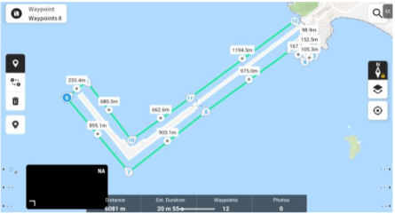
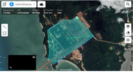
Before takeoff, the Emlid RS3 was activated to log positioning data. The Matrice 350 RTK with Zenmuse L2 then performed automated LiDAR scans, capturing millions of data points.
The data was processed in DJI Terra, which combined LiDAR scans with GNSS logs to generate georeferenced 3D point clouds. From here, the team conducted:
These deliverables ensured that decision makers had precise, actionable data to guide operations.
Why This Matters for the Minerals Industry
The benefits of this workflow go beyond speed:
Conclusion
The integration of the DJI Matrice 350 RTK, Zenmuse L2, Emlid RS3, and DJI Terra has transformed mineral exploration.
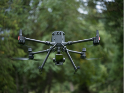
By replacing manual surveys with drone-based LiDAR, companies gain accurate data, safer operations, and faster results. This is not just an improvement. It is a new standard for stockpile management and mineral site mapping.
For an industry that depends on both precision and safety, the Zenmuse L2 is proving to be an indispensable tool for the future of exploration.